To start, I left Hucclecote and headed roughly North over Churchdown Hill, dropping in towards the village and out into Badgeworth. Now, I shall tell you at this point that I decided to keep my heart rate quite low, ideally below 165 bpm, this meant that I spent more time than normal in the small chainring and spinning at a reliable 90-100 rpm. For all that, overall speed didn't seem to suffer so quite happy with that. The only thing that conspired against me was the wind. Strong enough to make quite a difference yet never a proper tailwind.
From Badgeworth Lane, I turned left to Cold Pool Lane and through Up Hatherley and onto Shurdington Road. Crossing Shurdington Road, I head towards Leckhampton on the delightfully named Kidnappers Lane. This takes us out right by St Peter's church, Leckhampton. On this occasion, however, it's not the church I am after. Rather Ordnance Survey indicates a moat on the other side of the road. You can't ride right up to the moat but it is on a footpath so it's a hike of 100 metres or so. The moat is dry but a quick jump down into reveals some squelching so I guess it isn't always as dry. Maybe I'll go back when we have had some more wet weather and let you know. Anyway, the enclosure is only small and nineteenth century excavations turned up stones that probably formed the foundations of a bridge from approximately 10th century and a paved road from the church so it is possible that it was related to an earlier (Saxon) place of worship on the same site.
Back on the road and off to Shurdington. I've never really taken any notice of Shurdington before, save that it is between Gloucester and Cheltenham and I have ridden or driven past it a million times. Shurdington has existed as a village since Norman times and has a rather lovely church that bares testimony to it's age. It also has a street naming convention in common with many other villages. Imagine the medieval town planners meeting:
"Right, we need to give these new-fangled roads a name so people will know where they are going."
"That's not neccessary, no-one can read"
"No but let's show willing. Shall we start with the lane with the church on it?"
"Oooh, I know, there's learning done there. So how about school lane?"
"Good, I like it. Now, how about the lane with a school on it?"
"Bugger, can't think of anything for that one."
 St Paul's, Shurdington church is, in fact, a magnificent although very small Norman building with a very impressive 109 foot tall spire that has been repeatedly struck by lightning and repaired, there are a number of dates inscribed in the spire from where renovation work was carried out. One (probably apocryphal) tale regarding the spire is that the builder took his own life, so distraught was he that he was unable to match the spire at nearby St Peter's.
 The church has, as you would expect, been much changed and added to in its lifetime. One benefactor, immortalised in an inscription on the sundial on the South wall, is the Gwinnet family, a family of wealthy local merchants who acquired Bageworth manager during the reign of Elizabeth I. One of the ancestors of this family was one Button Gwinnet who was one of three representatives of Georgia who signed the US Decleration of Independence.
 Behind the church are the school rooms, probably mid-eighteenth century dame or Common Day school, that were used for there original purpose until 1981 when they joined up with Badgeworth. The buildings are now in use for the communtiy.
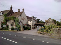
Leaving the village and crossing the main A46 (Shurdington Road) I cross into Farm Lane. I wonder what might have been here when the planners got together? I strongly expect that the Cheese Rollers pub or at least the buildings behind used to form the farm, but can't be sure. This lane is just a short diversion loop off the main road more or less just doing a lap of the pub grounds. It is also home to a jolly uninspiring grey building that is Shurdington Chapel.
Back onto the A46 and towardsBrockworth and I have time to spare so, where better to sit back and take in the view for half an hour so? Back to where the blog all began, to Witcombe Roman Villa. In fact, the road here is the steepest climb of the day. Deceptive but quite a climb none the less and giving fantastic views over Witcombe.

Total distance - 26 KM
Average Speed - 27 KM/h
Weather - about 23C, Dry, wind from SW, about 30 KM/h


